 you
are here » st. joe river homepage
» wmp
»
tasks » task
2 » digital elevation modeling (3-D image)
you
are here » st. joe river homepage
» wmp
»
tasks » task
2 » digital elevation modeling (3-D image)
you
are here » st. joe river homepage
» wmp
»
tasks » task
2 » digital elevation modeling (3-D image)
|
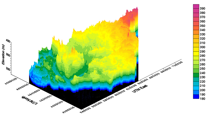
Digital elevation modeling and subwatershed delineation was conducted using 30-meter resolution data. The above image presents a three-dimensional view of the watershed. The X axis represents north and south locations. The Y axis represents elevation. The Z axis represents the east and west locations. All units are in meters. The elevation ranges from 173 to 390 meters above sea level. The red colors in the top right of the image represent the headwaters of the watershed in Hillsdale County, Michigan. The mouth of the river in Berrien County, Michigan can be seen on the left side of the image. Back to digital elevation modeling page. |