 you
are here » st. joe river homepage
» wmp »
tasks »
task 3 » federally regulated facilities
you
are here » st. joe river homepage
» wmp »
tasks »
task 3 » federally regulated facilitiesyou
are here » st. joe river homepage
» wmp »
tasks »
task 3 » federally regulated facilities
|
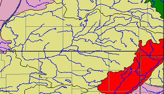
The USEPA Enviromapper for Watersheds program maps federaly regulated facilities and Indices of Watershed Health. The colors of each watershed above (St. Joseph is in the center in yellow) indicates its relative health. See the map below for watershed labels and a legend. Click on areas of the map above to zoom in (to an 18 mile radius) to cities and villages in the watershed. Those maps will display federally regulated facilities including NPDES dischargers (red), Superfund sites (orange), RCRA sites (green) and Toxic Release Inventory faciilties (blue). They were extracted as images from the Enviromapper Program. Alternatively, view the Superfund, NPDES and RCRA facilities on separate maps by clicking here. |
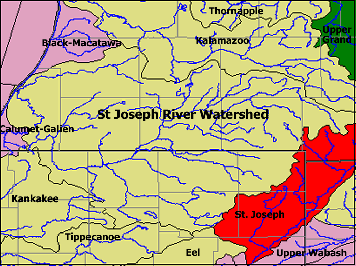
Watershed Legend
Green: Better Water
Quality, Low Vulnerability
Yellow: Less Serious Water Quality Problems, Low Vulnerability
Pink: More Serious Water Quality Problems, Low Vulnerability
Red: More Serious Water Quality Problems, High Vulnerability