 you
are here » st. joe river homepage
» wmp »
tasks
»
task 3 » floodplains
you
are here » st. joe river homepage
» wmp »
tasks
»
task 3 » floodplains you
are here » st. joe river homepage
» wmp »
tasks
»
task 3 » floodplains
 |
 |
|
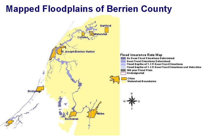
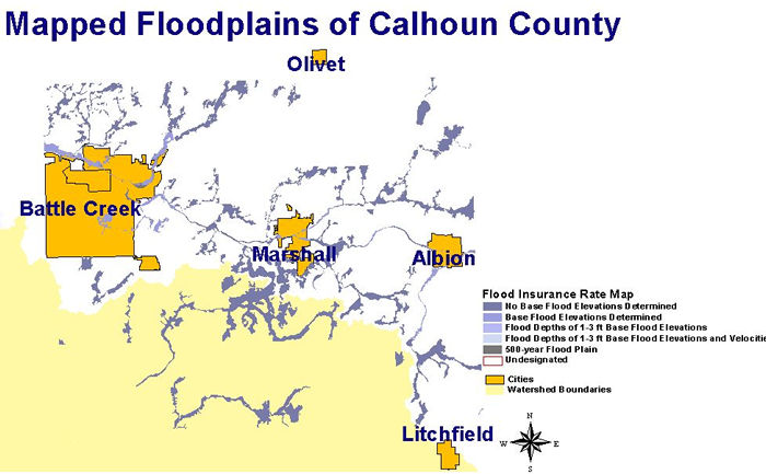
Electronic Flood Rate Insurance Maps (FIRMs) were available for Berrien and Calhoun Counties from the Michigan Center for Geographic Information. These maps are produced by the Federal Emergency Management Agency and identify floodplain areas. Floodplain areas are sensitive areas in a watershed and should be left undeveloped, when possible, to allow for infiltration of flood waters. Click the images or the links above for a larger view of the FIRMs. |