 you
are here » st. joe river homepage
» wmp »
tasks »
task 3 » npdes pII
you
are here » st. joe river homepage
» wmp »
tasks »
task 3 » npdes pIIyou
are here » st. joe river homepage
» wmp »
tasks »
task 3 » npdes pII
Click
on the map to see the extent of the urbanized areas.
|
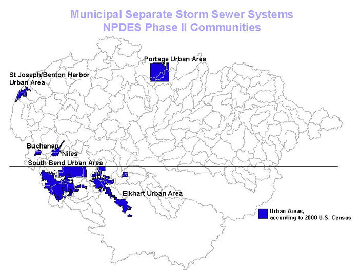
In Phase I of the NPDES (National Pollutant Discharge Elimination System) Program, urban areas with populations over 100,000 people were required to obtain a permit for stormwater discharges. Phase II regulates MS4s (municipal storm sewer systems) in mapped urban areas, as delineated by the 2000 U.S. Census, and communities outside of mapped urban areas having populations greater than 10,000 people and densities greater than 1,000 people per square mile. Each state may determine whether to include the latter type of community in its Phase II program. Sturgis and Coldwater, MI fit this criteria. However, Michigan's draft rule does not require these communities to apply for Phase II permits. No areas in the Indiana portion of the watershed meet these criteria. The blue areas above depict mapped urban areas. Click on these areas to see a map of the extent of the urbanized area. Note: Buchanan and Niles and portions of Cass County, MI are included in the South Bend Urban Area. The Villages of Shoreham, Stevensville, Benton Heights and Fair Plain, MI are included in the St. Joseph/Benton Harbor Urban Area. You can view the list of all Phase II communities in PDF format by state: Indiana, Michigan. You can also view maps of all urbanized areas in the United States by clicking here. |
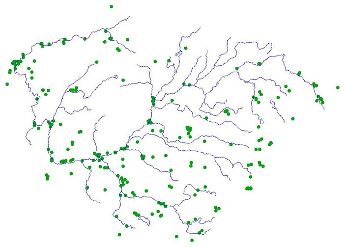
| Industrial and municipal waste water treatment facilities discharging to navigable waters of the U.S. regulated by the NPDES, downloaded from the USEPA BASINS program. View other federally regulated facilities. |